Ballyvaughan to Clifden via Connemara
This route, along the Wild Atlantic Way, from Ballyvaughan to Clifden in co Galway, is quite a long drive, with a lot of places to see and stop at along the way.
We actually managed to do this route on bikes, on top of driving from Kilrush to Ballyvaughan, in just one day.
However, we did not stop at all the sites the first time around. There was not enough time. I went back alone to visit some of the POI’s later on. Depending on how much you want to see, you may want to split this journey into two days, or three if you wish to visit the Aran islands.
The route actually begins in Co. Clare but then works along the coast into Connemara with some great views out to the Aran Islands.
Some POIs are more interesting than others, so you will have to decide for yourself where you want to stop.
Whilst the road out of Galway is nothing particular to speak of, Silverstrand Beach and Cartron Harbour are stunning, as is Coral Strand. And as you drive into Connemara the road looking at the Twelve Pins is just spectacular. In fact, most of the landscapes in Connemara are gorgeous.
Glynsk Pier and Dog’s Bay are also quite beautiful and well worth visiting.
The Wild Atlantic Way Signature point of Derrigimlagh is along this route where Alcock and Brown crash landed in the bog and Marconi managed the first commercial trans-Atlantic transmission of Morse code.
Wild Atlantic Way Galway Route Map – Ballyvaughan to Clifden
Approx. 226km distance, 4hrs 40 minutes driving time
Ballyvaughan Pier
Ballyvaughan is a cute little seaside village in County Clare. The pier was built in the 1830’sfor trade and fishing. In the past, the pier would have been used by fishing boats during the herring boom.


There are a few restaurants in Ballyvaughan and in the vicinity.
Traught Beach
This is an initially pebbly beach, which becomes sand as you go further out, which is popular for swimming.

The picture below is of a cruise boat that was docked in Galway. I took the photo from this beach. Public toilets are available at the beach.

Dunguaire Castle

This is a 16th-century castle, built in 1520, lying on the Wild Atlantic Way route that has tours and banquets you can visit.

Rinville Park
Rinville Park is one of the Discovery Points on the WAW, close to the village of Orangmore.
It has a picnic area with an ancient castle and playground and a large grassy area and car park.
Entrance is free and there are good views of Galway Bay.


Salthill Promenade
This approx. 3km stretch from the Blackrock diving tower to Claddagh Quay is a great place to walk along the sea edge.

You can normally park along here safely and enjoy a long stroll along the water.
You may need to be careful during very high tides and storms leaving your car here as it has been prone to flooding in the past. The Burren hills in Clare are visible across the water.
There is a campsite nearby from which you can cycle or walk into town.


Maybe you could grab a pint and some craic at the famous O’Connor’s bar in Salthill in the evening (remember the Galway Girl music video by Ed Sheeran?). They always have some pretty good live music there.

Or jump off the Blackrock Diving tower (make sure it is high tide beforehand!).

Silverstrand Beach
A gorgeous sandy beach, not far outside the city, accessible for cars with a limited height car park. Lovely over the bay to the hills of the Burren.


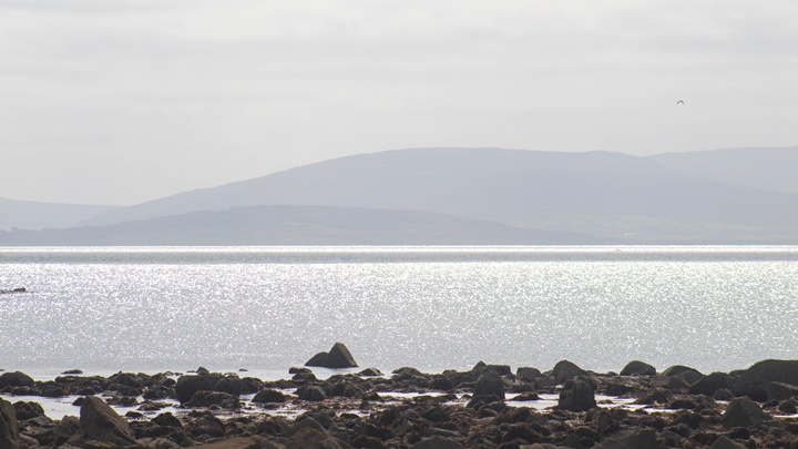

Spiddal Pier
A large pier with a beach and lifeguards during the season. Close to Spiddal with its own small fishing pier nearby.
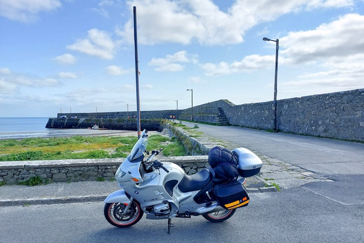


Connemara Airport
A small airport servicing flights to all three of the Aran islands (Inishmore, Inishheer and Inishmaan). Prices are fairly reasonable, especially considering the time you save.
Be aware that flights can be influenced by the weather.


Ballynahowen Quay (Cartron Harbour)
A beautiful quaint little fishing quay, accessible down a tiny little road.

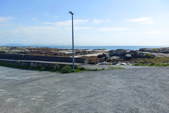
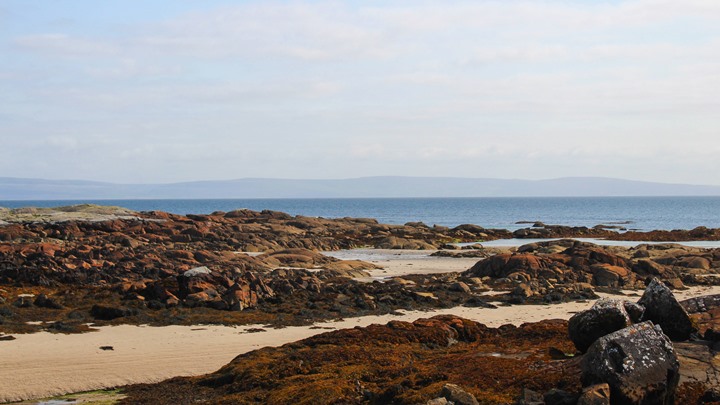

The quay only has limited parking, but I was the only one there when I visited. It is really a very special place.
There are great views of the Bay and out to the Aran islands on a clear day.
Rossaveel Harbour
Rossaveel (Rossaveal) Harbour is in the middle of the Connemara Gaeltacht area. It is about 37 km’s outside Galway and is one of the ports that brings people to the Aran Islands.


You can book your ferry trip to the islands here, or a Cliffs of Moher tour.
Inishmore / Inishmaan / Inisheer. The Aran Islands
The Aran Islands consist of Inisheer, Inishmaan and Inishmore. You can get a ferry to the islands from various locations.
A popular thing to do on Inishmore is to hire a bike and cycle around the island.

But make sure you are fit enough! A few areas are a bit hilly.

There is a lot to see on Inismore such as a naturally formed rectangular pool called the wormhole where they hosted the Red Bull cliff diving series in 2014. An amazing place.

You can also fly to the Islands from Connemara Airport.
Inishmaan is the middle island of the Aran Islands. There is one pub on the island. The Aran Islands are all Gaeltacht, meaning the main language is Irish.
Inisheer is the smallest of the Aran Islands. It is home to the wreck of the Plassey which you see as you sail past from Doolin in Clare.

This is famous from the introduction of the Father Ted comedy series that was filmed in and around County Clare.
Coral Strand
This beautiful, quiet beach with clear waters has some parking spaces available and is served by lifeguards during the summer season.

The beach is made up of dead bits of a strange hard seaweed called maerl that have been crushed by the sea and bleached by the sun.

Quite different to the normal sandy beaches along the coast.

Carrickalegaun Bridge
This bridge is at the Northern part of the causeway between Lettermore Island and Gorumna Island. There are several bridges that link this area, which is known as Ceantar na nOileán, the district of the Islands.

This is a Gaeltacht area, where Irish is spoken as the main language.


The area is very scenic and traditionally would have been reached with the Galway hooker type of boat.
Pearse’s Cottage
This new visitor’s centre, close to the entrance to the Ros Muc peninsular, celebrates the story of Patrick Pearse, one of the leaders of the 1916 Easter Rising, who was executed by the British.

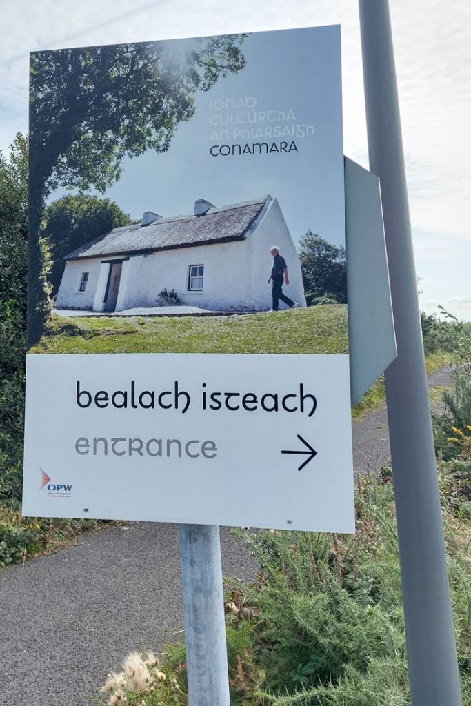

Make a tour of his cottage nearby where some of his work was written. There is a small entry fee.
Twelve Bens

This wonderful single-track road runs through a flat area with great views of the Twelve Bens of Connemara on a clear day.

A good shortcut if you are running out of time or an extra diversion if you have plenty of it.
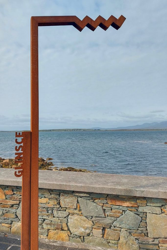
Glynsk Pier
This small fishing pier has great views over to the Twelve Bens (Twelve Pins) in Connemara.


Gurteen Beach
Gurteen Bay is a horseshoe-shaped protected beach that lies back to back with Dog’s Beach, separated by sand dunes.
Dog’s Bay
Dog’s Bay is another circular-shaped beach. The beach is separated from Gurteen Beach by the Dunes. Beautiful clear water and lovely on a sunny day.


Bunowen Bay
A pretty beach with the Connemara smokehouse situated 200m from the beach. Perfect for some freshly smoked mackerel or Atlantic salmon.

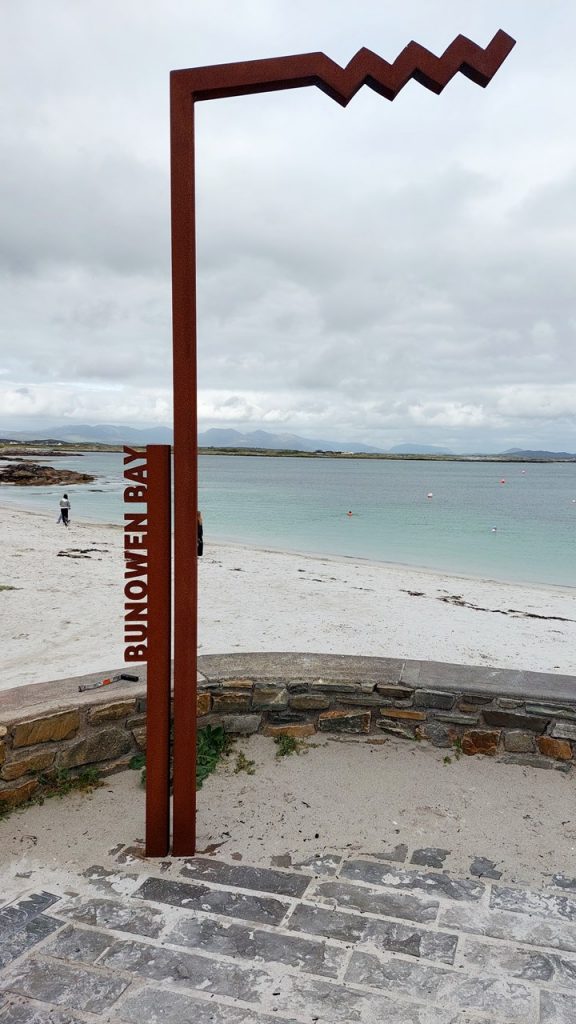

This beach is also very close to the Connemara Golf Links Club.
Derrigimlagh
A Signature Point along the Wild Atlantic Way, Derrigimlagh is the location of two early developments at the beginning of the 20th century. Firstly Marconi managed the first commercial trans-Atlantic transmission of Morse code from Derrigimlagh.
The radio station however was closed during the Irish civil war.


Secondly, in 1919 Alcock and Brown landed at Derrigimlagh making it the first trans-Atlantic flight from North America to Europe.
There is now an outside exhibition and parking space and walks out to the landing site and other interesting locations.
Alcock and Brown Landing site
This is the landing site of the first non-stop transatlantic flight from Newfoundland to Ireland, made by John Alcock and Arthur Whitten-Brown in June 1919. They made the flight in a Vickers-Vimy-Rolls bomber. Quite a few things went wrong with their aircraft during the crossing, especially their landing.
They thought they were landing in a nice green field but it turned out to be Derrigimlagh bog, which caused the plane to nose dive into the ground. Both survived the landing though.
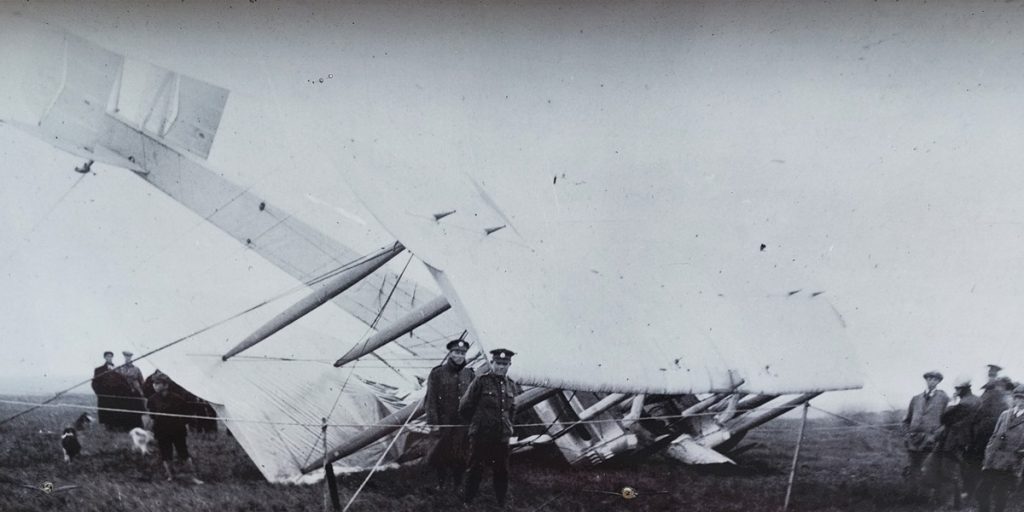
There is a statue of the two aviators, that used to be located at Heathrow airport, now in the centre of the town in Clifden, which is near the landing site.
Clifden Camping
This is a great campsite with super facilities including gas cooking, a fridge and a place to eat. Watch out though for the midges though! These nasty little bugs do not give up and are common in Donegal during the summer months. However, they do sell ‘Smidge’ in the reception here which which will keep them at bay!
You can walk into Clifden town from the campsite, but it is quite a walk.

TRAVELING TO IRELAND SOON?
Here are my recommended travel resources for planning your trip:
- Book your flights: Expedia & Kayak
- Hotels & Accommodation: Booking.com, Hotels & VRBO
- Tours & Activities: GetYourGuide
- Car Rentals: Booking.com, Expedia or Discovercars
- Interactive Wild Atlantic Way Guide Maps
- Travel Essentials: Ireland Packing List
Next Route – Going South
Next Route – Going North
I have spent many (fun) hours creating this website to help people travelling the Wild Atlantic Way. If you found it useful and it helped you plan your trip, please consider donating towards my petrol/gas bill! Many thanks!
Last Updated on October 13, 2025 by Gav
