The Coastal Road in Northern Ireland
The Causeway Coastal Route through Northern Ireland passes along the coast from Derry to Belfast (or Belfast to Derry) via the counties of Derry, Antrim and Down. The Giant’s Causeway, which is located along this road, gives its name to this route.
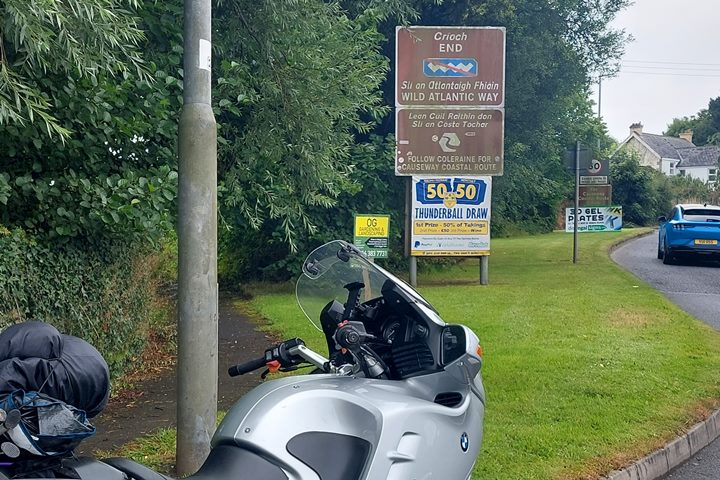
The Causeway Coastal Route is not officially part of the Wild Atlantic Way, as this part of the coast road is located in Northern Ireland, which is part of the United Kingdom of Britain and Northern Ireland (the UK). And really it does feel as if you are in a different country to Ireland.
The local currency is British Pounds, the seaside towns feel just like all other typical British seaside towns, they use miles rather than kilometres and the people have a very pronounced Northern Irish accent. But luckily they also drive on the left-hand side of the road!
For some general advice about driving in Ireland, follow the link here. But bear in mind that as soon as you enter Northern Ireland, you will notice that the style of the signposts does change to the UK style.
The border is these days difficult to notice, so you may not even notice crossing it, but the signs will change. So remember that the speed signs are in Miles and to drive on the left!
What is the Causeway Coastal Route?
The Causeway Coastal Route is a route along the Northern Coast of Ireland in the UK. The route takes you from Derry (Londonderry) to Belfast, or vice versa. It is approximately 140 miles long and you can in theory drive it in a day.
To explore properly and visit some of the attractions along the way you should allow yourself 3 to 5 days, depending on what you want to see. There are quite a few filming locations from Game of Thrones along this route. I allowed 3-4 days to complete the trip, on my way to the Isle of Man on the ferry out of Belfast.
The route is not as well organised as the Wild Atlantic Way, with clearly identified Discovery and Signature Points, but it does have quite a few points of interest along the way. You can find these on the map below.
There are some pretty areas along this route, but you may be disappointed if you have done the Wild Atlantic Way first. The WAW is clearly a lot longer and has a much wider range of stunning scenery and places to experience.
You may also find that some of the information boards along the Causeway Coastal Route are illegible or difficult to read. They were not all designed to deal with the weather it seems.
Map of Causeway Coastal Route Google Maps
This is the route below. You can download the route to your phone by clicking the top right-hand corner.
Approx. 141 miles distance, 4 hrs 15 minutes driving time
The Causeway Coastal Route
Any trip to Ireland is not complete without a trip to the Wild Atlantic Way. Depending on how you arrive in Ireland it may be worth your while to travel the Causeway Coastal Route as well, either to get there or to get back.
If you arrive in Belfast by plane or boat, for example, the logical trip is to go west and head out to Derry along the coast, and then travel the WAW in Donegal from North to South. And vice versa if you are travelling back home via Belfast or Larne.
If you are at the end of the WAW in Muff, the signpost guides you to Coleraine in Derry to join up with the Causeway Coastal route.
I drove the road from West to East, so I will describe going in that direction. If you download the route to your phone or tablet you can use it to navigate to the points of interest you wish to visit.
Let’s describe what you will find along this route.
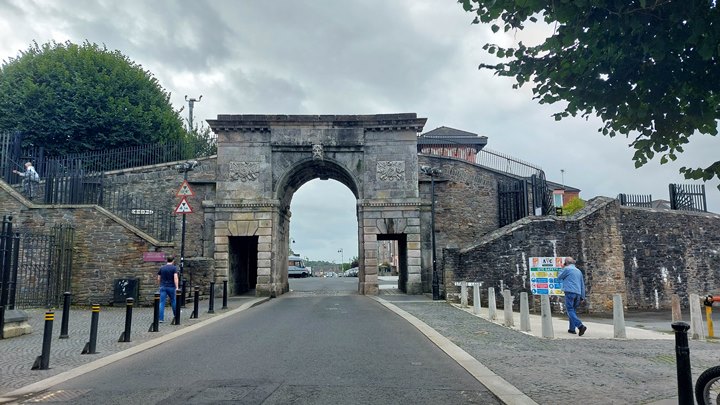
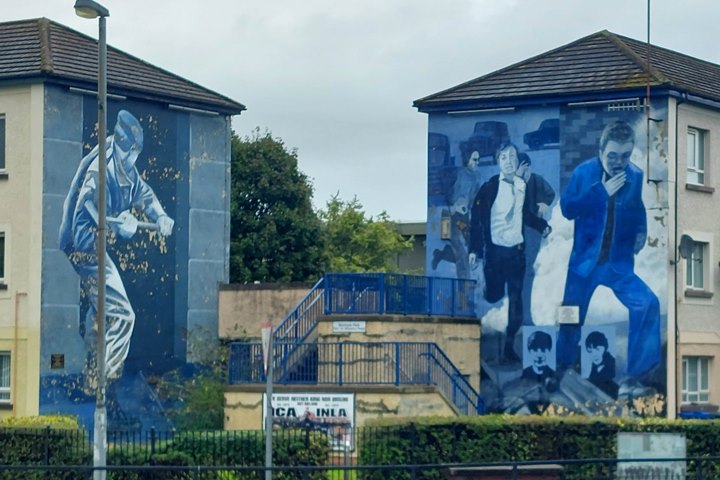
Derry (Londonderry)
Once you hit Derry (also known as Londonderry by Unionists), you know you have now entered the United Kingdom. But as you are so close to Derry when you get to Muff, it is worth the short trip.
And Derry is the start of the Causeway Coastal Route.
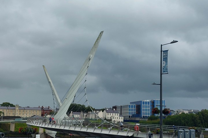
So why not visit the Peace Bridge, Bishop’s Gate, Free Derry Corner or the Derry Girls Mural, to mention a few of the sights?
Derry is the second largest city in Northern Ireland and the fifth largest on the island of Ireland.
So now you are in Derry you can start the Causeway Coastal Route along the Northern Irish coast to Belfast.

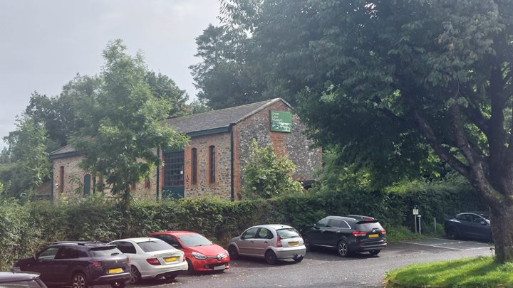
Roe Valley Country Park
This charming park has lovely woodland walks and river views. There are possibilities to fish for salmon and trout in the river and you can canoe and rock climb.
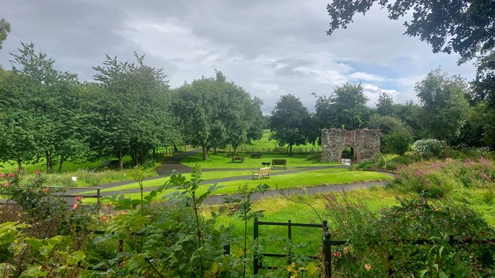
There is a visitor centre and cafe. Situated within the park there is the Green Lane Museum which tells about rural life in the 19th and 20th centuries.
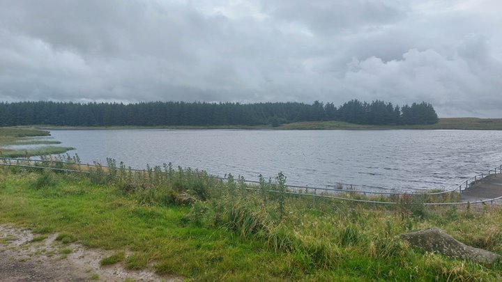
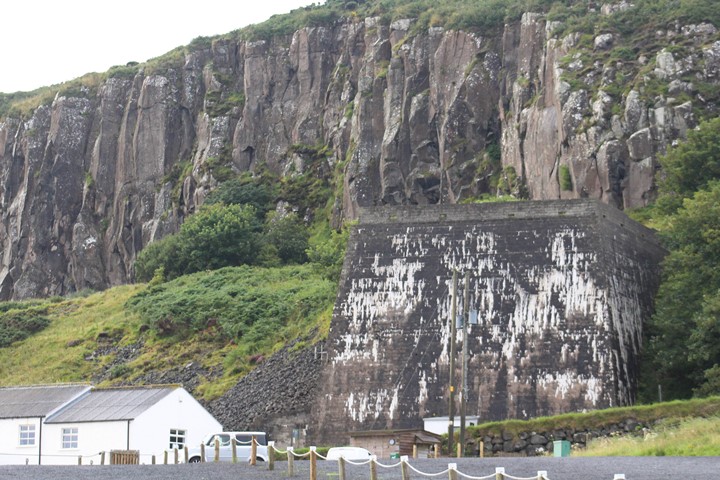
Binevenagh
Binevenagh (Binn Fhoibhne) or Foibhne’s peak, is a large hill in county Londonderry (Derry). Classified as an area of Outstanding Natural Beauty, there are great views into the valley.
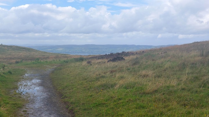
I was there on a rather overcast and grey wet day unfortunately so my pictures are not brilliant. On a clear day, the locals use the slopes for gliding and hang gliding.
I made a video of the dirt track to the lake though on my bike, which was quite challenging with a few nasty holes and ruts on the road. The turnoff is easy to miss as you can see in my video.
Martello Tower At Magilligan Point
Martello towers are named after a fort in Corsica at Mortella Point. The British Navy bombarded that fort in 1794 and it survived, impressing the British. They then copied the design of the tower and built about 200 of them around the British and Irish coasts and other locations in the British Empire.
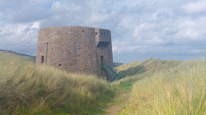
This tower at Magilligan Point is one of the better-preserved ones along the Irish coast. They finished building this tower in 1817. Back then it would have been closer to the coast.
But since then the sand dunes have shifted and there are ridges between the tower and the Point. The purpose of the tower was to protect the mouth of Lough Foyle.
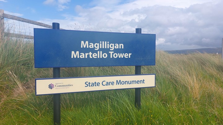
The tower is located a short walk from the Ferry to Greencastle that leaves from Magilligan Point.

Benone Beach

This is a sandy beach that stretches all the way to Magilligan Point. I took these pictures at Downhill Beach which blends into Benone heading west.
Cars drive onto the beach, but as always you need to watch out for the tides and soft sand!
Mussenden Temple

This National Trust site is located on the cliff top and is a 10-minute walk from the Lion’s Gate parking at the top. There are wonderful views down to the sandy beaches below.
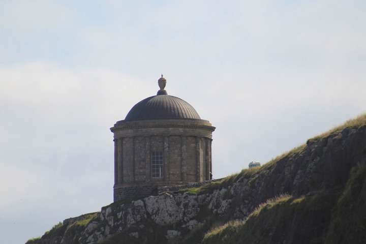
The building was built in 1785 and was based on Bramante’s Tempietto on Mount Giancarlo, which itself was copied from The Temple of Vesta at Tivoli near Rome. This building was the estate’s library.
They named the building after Mrs. Frideswide Mussenden, the cousin of Earl Bishop. The building had a fire burning constantly in the basement to stop the books from getting damp. Over the years the building has got closer and closer to the cliff edge due to erosion.
Downhill Demesne

Downhill Demesme is the name of the estate. Here you can park and access the estate / Downhill House and the Mussenden Temple library building (which is closed).
The estate belonged to the Earl Bishop, Frederick Hervey. There is a lot to see at this National Trust location.
The Bishop’s Gate
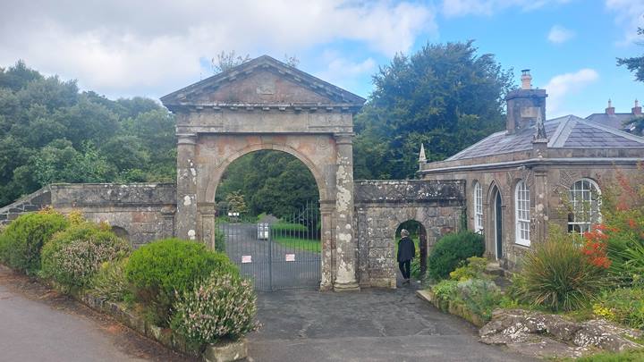
This is another entrance to the Earl Bishop’s estate. Through this entrance, you can get to the Bishop’s Gate bog garden. The garden is presently in the process of being brought back to a normal state after years of neglect.
There is an old dovecote and ice house. They would fill the ice house with ice in the winter in order to keep the meat cool in other months.
Castlerock Beach
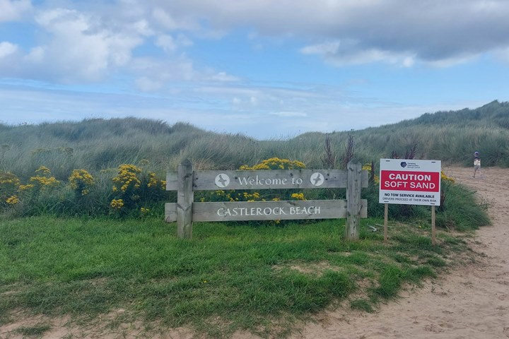
A 1km long beach between the cliffs of Downhill and the lower River Bann estuary. Be aware of tides if you take your car onto the beach and the soft sand that can make access more difficult.
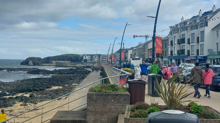
Portstewart
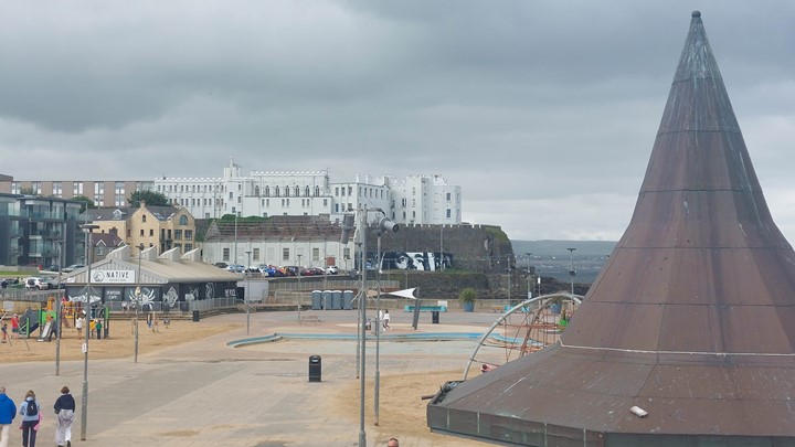
To me as an Englishman, Portstewart felt like a very typical British seaside town. There are shops, cafes, pubs, chippies and ice-cream shops all along the front (the prom).
I stopped here for a typical English breakfast at a local cafe that was heaving with people. I wish I hadn’t, but I needed to eat.
After a pretty disappointing meal, I struggled to leave the town in the traffic that had built up. Luckily I was on a motorbike which made it easier, but I have not encountered traffic jams like this on the WAW.
So it was not my favourite place on this trip, but don’t let me put you off.
Portstewart is also known for the North West 200 motorcycle road race. This race passes through Portstewart, Coleraine and Portrush. This attracts lots of visitors every year and must be quite a spectacle.
Portrush
The next town down the road from Portstewart, Portrush is another typical British seaside town. Portrush is known for its beaches and especially for its golf club. It also hosts the NW 200 motorcycle road race that passes through Portstewart, Coleraine and Portrush.
White Rocks Beach
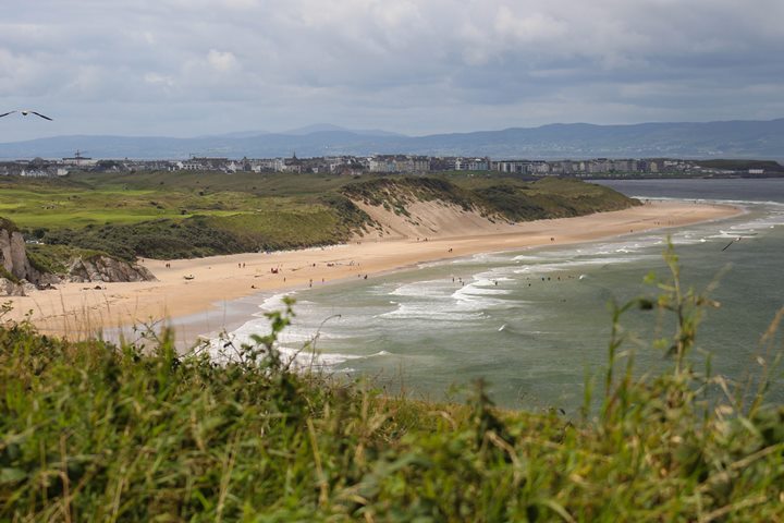
This beach is popular for its caves in the limestone cliffs. The wind direction may determine your level of enjoyment on the beach.
I took this picture from the Mageracross Viewpoint. This viewpoint has a large parking spot to stop and picnic. There are good views back to White Rocks beach and cliff views from the lookout viewing platform.
Various Links Golf Courses
There are several lovely links golf courses along the Causeway Coastal Route that are worth visiting if you are a golfer. I show these golf clubs on the route map. They include courses such as Castlerock, Portstewart, Royal Portrush and Ballycastle Golf Clubs.
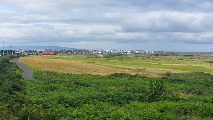
And they are all fairly close together so it is a good place to come for a golfing week, for example.
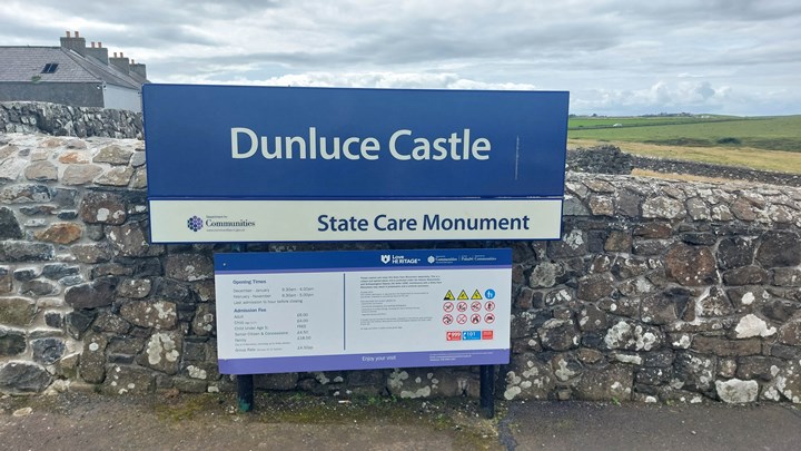
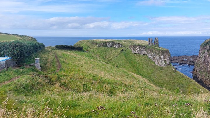
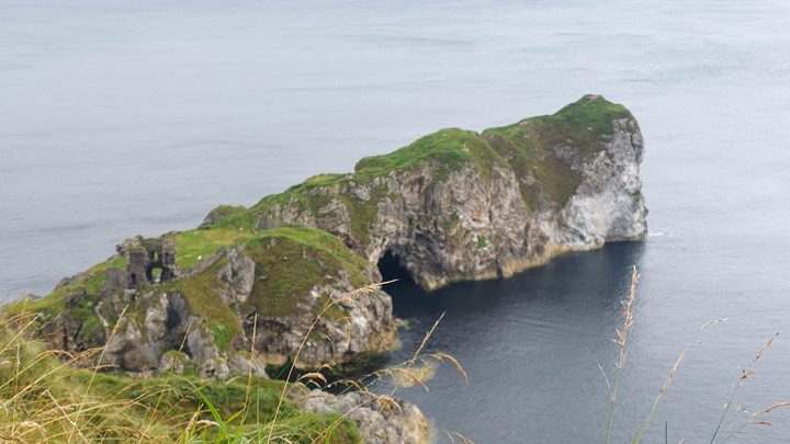
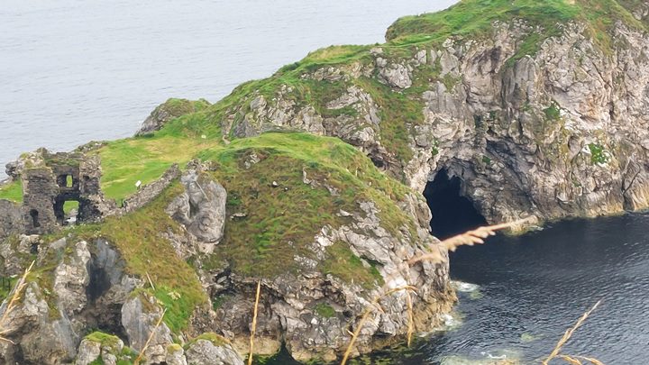
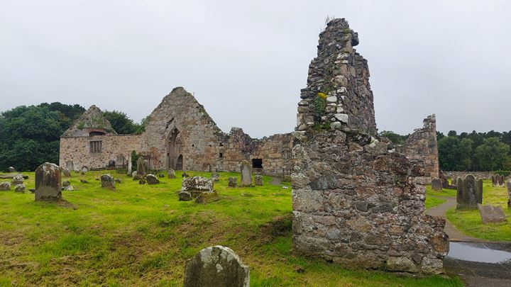
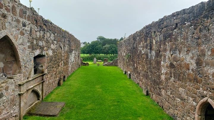
Dunluce Castle
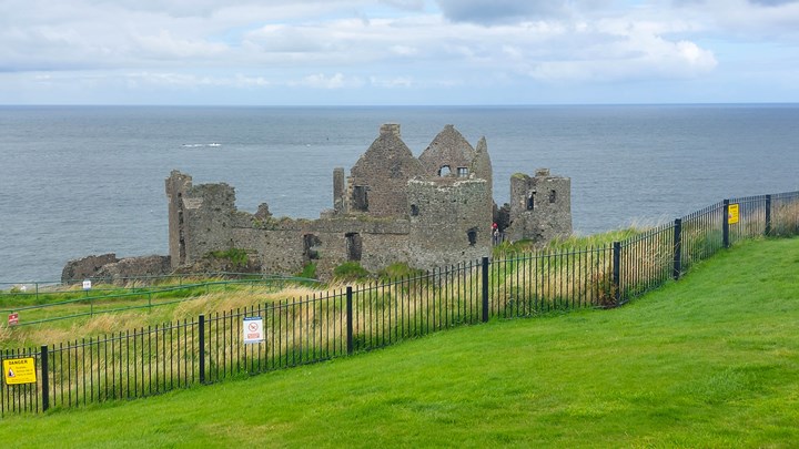
This impressive ruin lies on the edge of a basalt outcrop. There is a bridge that connects the outcrop to the mainland. The castle dates back to the 13th century and was the seat of the MacDonnell clan.
It has very steep drops on all sides making it easy to defend. There is a story that at one point the kitchen collapsed into the sea, due to erosion of the cliff. Only the kitchen boy survived according to the story.
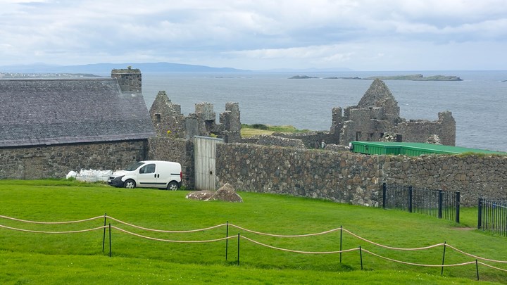
There is a car park from which you can walk down to the castle.
In Game of Thrones, they used some shots of this castle where it represented Pyke Castle of the House of Greyjoy.
Portballintrae

Portballintrae is another small seaside village along this coast. It has a small population.
Bushmills Distillery

The Bushmills distillery is the oldest licensed whiskey distillery in the world. The Distillery received its license back in 1608. The distillery is only a few miles from the coast and you can do a tour of the distillery here.

The tours teach you about the copper pot stills. They also show you how they triple distil the single malt whiskey during the production process.

The whisky relies on the water from the local river Bush.
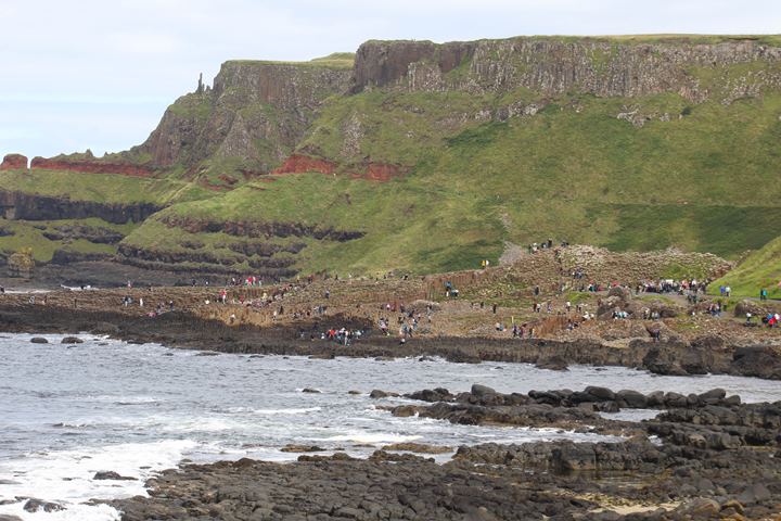
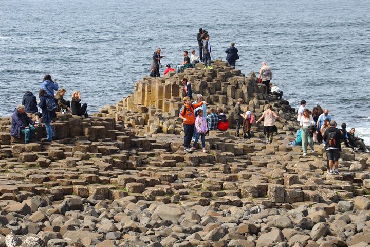
The Giant’s Causeway – a Causeway Coastal Route Highlight
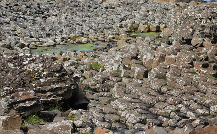
The iconic Giant’s Causeway is famous for its interlocking hexagonal basalt columns. It is the result of a volcanic eruption. Most of the columns are hexagonal, but some have 4, 5, 7 or 8 sides.
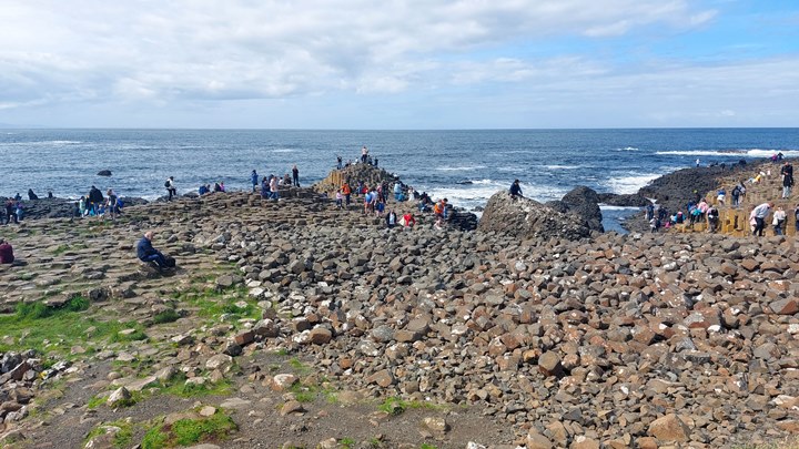
Like many of the attractions along the Causeway Coastal Route, the National Trust manages this site. You should book tickets before you go to ensure a car parking space.
There was a long queue to park when I went. National Trust members get in free.
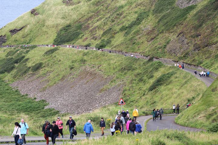
There are different alternatives to get to the causeway itself. You can walk, or get a bus down.
It is quite a long walk from the car park, maybe about one mile. There are likely to be plenty of people as well, as there were when I visited as you can see from the photos.
The bus costs one pound, and I took it back up, as it is all uphill to return to the car park.
Dunseverick Castle
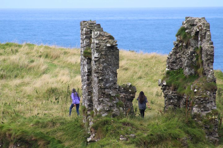
This is yet another remains of a castle perched on a cliff. Unfortunately, only the ruins of the gate lodge remain.
The initial fortification here dates back to the 5th Century, and it changed hands over the years. It is recorded that St. Patrick visited here in the 5th Century. Dunseverick Castle was where St. Patrick baptized Olcán, who later became the Bishop of Ireland.
It became the centre of the Earls of Ulster in the middle of the 13th century and a stronghold of the MacDonnells from 1560 AD. The National Trust owns the site but the Northern Ireland Environment Agency controls it.
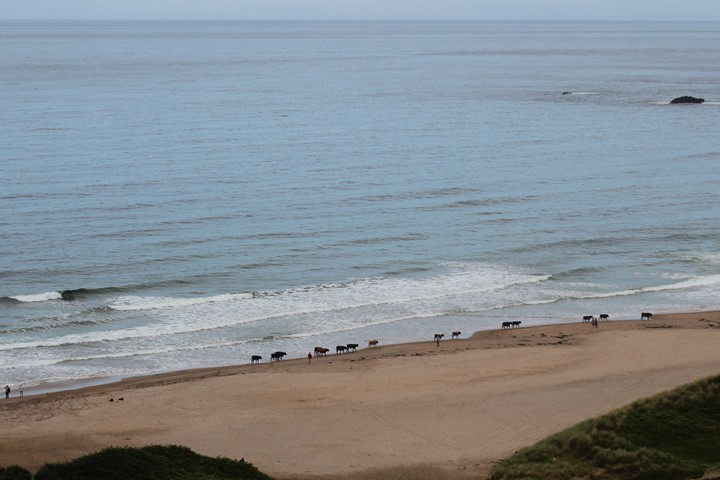
White Park Bay
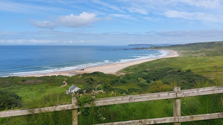
This lovely sandy beach has a small car park with a rough gravel surface. There is a quite tricky walk down to the beach, especially when wet.
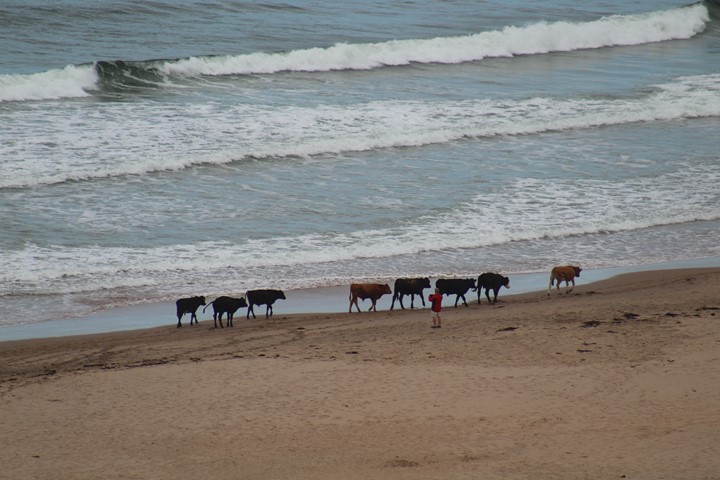
When I was there there were cows walking along the beach. So it is important that you keep your dog on a leash. Swimming on the beach can be dangerous as there can be strong rip tides, and there are no lifeguards on the beach.
There is a great youth hostel here that I stayed at for one night. The living room has a superb view down to the beach and the rooms were clean and sufficient. It has a large industrial-sized kitchen which the inhabitants can use.
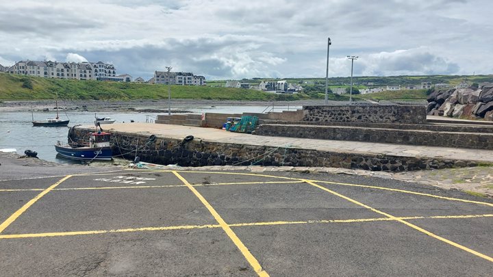
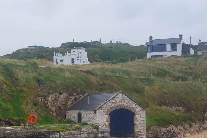
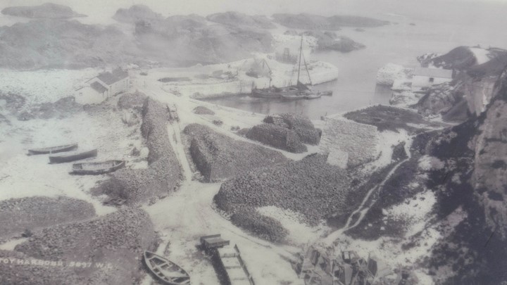
Ballintoy Harbour
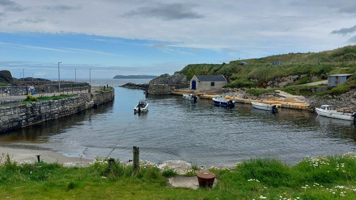
This is a small picturesque fishing harbour which is located at the end of a small steep road. It is very pretty and certainly well worth visiting.
During the 2nd season of Game of Thrones, they used the village as the town of Lordsport on the Isle of Pyke.
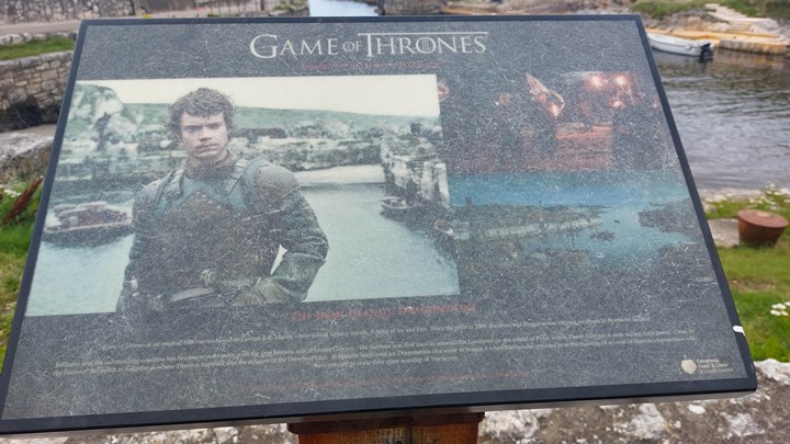
Fans of the show will recognize it as the setting for the rugged Iron Islands. This is where they filmed Theon Greyjoy’s homecoming scenes.
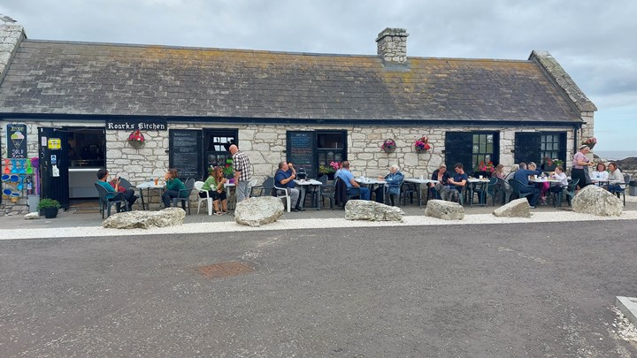
There is a charming little cafe Roark’s Kitchen selling freshly made food, and locally caught mackerel, located at the harbour. A great place to stop for a picnic.
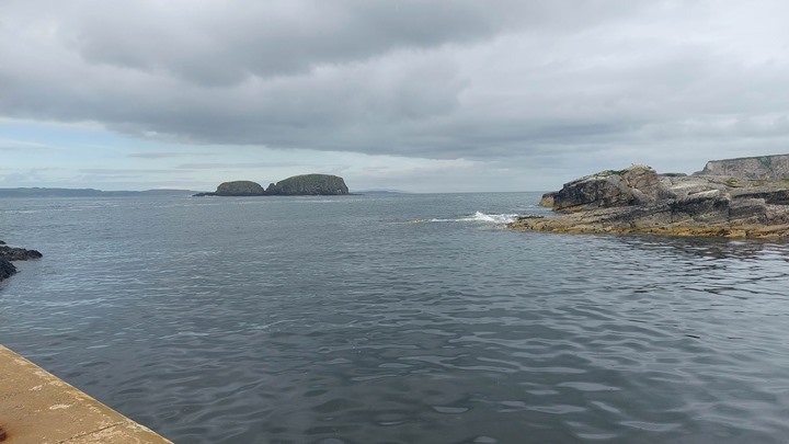
The harbour was once a bustling hub for fishing and trade. Remnants of its seafaring past can still be seen in the quaint fisherman’s cottages and the stone boat shelters that dot the area.
There is even a house in the form of a boat on the road out of the harbour.
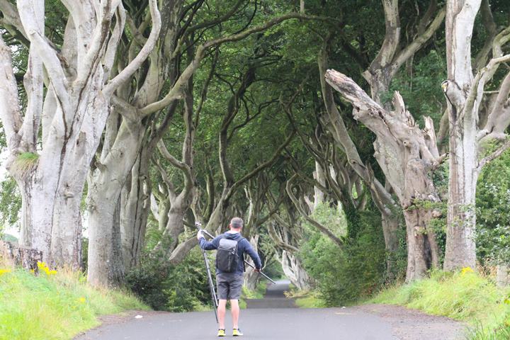
The Dark Hedges – another Causeway Coastal Route highlight
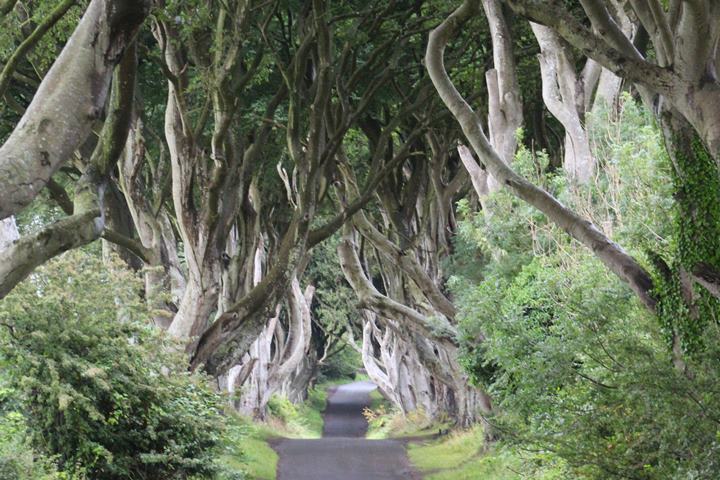
This is another iconic location in Northern Ireland that became famous with the Game of Thrones TV series. The Dark Hedges in the series was the Kingsroad in the Game of Thrones.
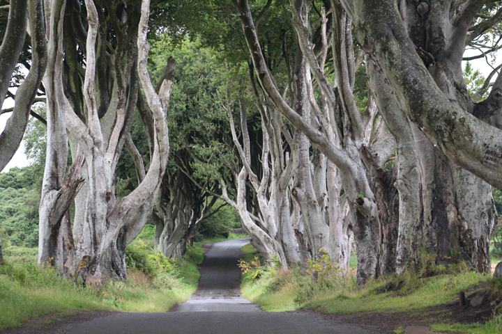
The road is a hauntingly beautiful avenue of beech trees located in County Antrim. This enchanting natural phenomenon is famous for its otherworldly appearance. The gnarled and twisted trees form a tunnel-like canopy, their branches intertwined to create an eerie, atmospheric passageway.
I visited at 06.00 a.m. to make sure I could take some pictures with no other people in them. And yet after 15 minutes a lone photographer did appear!
I also rode through the lane on my bike, without noticing a VERY large puddle that was waiting for me beyond one of the undulations! I did get a little bit wet! See it here:
Carrick-a-Rede Car Park
This is the main car park for the Carrick-a-rede rope bridge. I arrived here at 07.00 in the morning and walked down the hill as the gates were closed. Only then did I realize that it was still quite a walk (1.2km) to get to the rope bridge, so I gave up and walked back up.
The Larrybane Quarry (also Game of Thrones) is at the bottom of this car park to the left. During Game of Thrones, they used the Quarry as a filming location in Season 2.
The iconic destination of Carrick-a-rede is renowned for its stunning rope bridge that stretches across a 66-foot (20-meter) chasm. The rope Bridge, connects the mainland to the small Carrick Island.
The bridge was first erected in 1755 by the salmon fishermen who used to fish from the island.
The bridge itself is an exhilarating experience, swaying gently in the breeze as you traverse it, providing incredible panoramic views of the rugged coastline and the deep blue waters of the North Atlantic Ocean below.
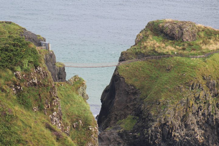
Carrick-a-Rede translates to “The Rock in the Road,” a fitting name for this geological wonder.
The area is known for its unique basalt columns, formed by ancient volcanic activity, which adds to its geological significance. The surrounding cliffs and sea stacks contribute to the dramatic beauty of the site, making it a paradise for photographers and nature enthusiasts.
For history buffs, Carrick-a-Rede also has a rich cultural heritage, with evidence of salmon fishing huts that date back to the 17th century. These huts are a reminder of the area’s traditional fishing industry, which relied on the annual salmon migration passing through the nearby waters.
Whether you’re crossing the rope bridge, exploring the coastal paths, or simply enjoying a moment of serenity amidst the stunning surroundings, Carrick-a-Rede is an unforgettable experience for all who venture there.
Kinbane Castle

Kinbane Castle is another captivating medieval ruin perched dramatically on the Northern Irish coast near Ballycastle. This historic fortress boasts a stunning location atop a rocky promontory overlooking the North Atlantic Ocean, making it a must-visit for history enthusiasts and those seeking breathtaking views of the Irish coastline.
The castle’s history dates back to the 16th century. Colla MacDonnell, a Scottish chieftain, built the castle, as a defensive stronghold against potential invaders. Over the centuries, Kinbane Castle has seen its share of battles and conflicts, playing a role in the tumultuous history of Northern Ireland.
Today, the castle stands in picturesque ruins, with remnants of its once-impressive walls and towers. Visitors can explore the site, wandering among the ancient stone walls and imagining the castle’s past grandeur.
The location itself, with the castle perched precariously on the rugged cliffs, is a sight to behold, offering breathtaking panoramic views of the coastline and the crashing waves below. I was there on a calm day.
Reaching Kinbane Castle involves a short hike along a scenic coastal path that adds to the adventure. This historical gem provides a tranquil escape, where visitors can soak in the beauty of the natural surroundings while contemplating the castle’s storied past.
Ballycastle
Ballycastle is a charming seaside town nestled along the picturesque Causeway Coast. It is a delightful destination that offers a perfect blend of natural beauty and Irish charm.
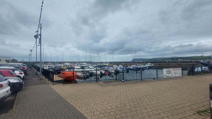
Ballycastle is renowned for its lively atmosphere, especially during the summer months. During the summer visitors and locals alike flock to its sandy shores and enjoy the annual Ould Lammas Fair, a centuries-old event known for its vibrant street markets and traditional festivities.
I had a very good breakfast at the Marine Hotel on the waterfront near the Marina.
Rathlin Island

This island is Northern Ireland’s most Northerly point. About 150 people live on the island, which is about 4 miles long. The shape of the island is a reversed L.
There is a ferry to the island from Ballycastle, about 6 nautical miles away.
Rathlin is a special area of conservation in Northern Ireland and is home to many types of seabirds. There is a cave on the island called Bruce’s Cave. Robert the Bruce, or Robert I of Scotland, gave his name to the cave. It was supposedly in this cave that Robert saw the spider that inspired him to continue to fight for Scottish independence.
HMS Drake was torpedoed and sank off the island in 1917.
Bonamargy Friary
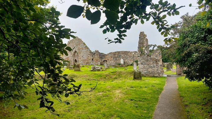
This historic monastery is located near Ballycastle. Founded in the late 15th Century, this Franciscan friary is a testament to the rich religious heritage of the region.
There is a small car park, from which it is a short walk to the ruins.
The friary boasts impressive Gothic and Renaissance architecture, with relatively well-preserved ruins that include a church, a tower, and a cloister.
Visitors are transported back in time as they explore the ancient stone archways, weathered tombstones, and the serene atmosphere that surrounds the site.
One of the most notable features of Bonamargy Friary is the tomb of Sorley Boy MacDonnell and his wife, which is within the friary grounds.
Sorley Boy was a prominent figure in Irish history, known for his role in the MacDonnell clan’s struggles in the 16th Century.
There is a vault containing the remains of other members of the MacDonnell family, including the 2nd Earl of Antrim, Randal Macdonnell, who died in 1682.

Today, Bonamargy Friary stands as a captivating historical site where visitors can appreciate both the architectural beauty and the cultural significance of the place.
Its tranquil surroundings and well-preserved ruins make it a peaceful and thought-provoking destination for those interested in history and spirituality.

Murlough Bay

This is another Games of Thrones location, located between Fair Head and Torr Head. It is accessible via a single-lane road, which passes through pastures with sheep grazing freely.
There are a few steep parts on the way down towards the coast. At some point, you reach a gate from which you have to walk further.

Sir Roger Casement, a British Diplomat and Irish Nationalist asked his cousin if they would bury him in Murlough Bay. This was while he was in prison at Pentonville Jail.
The British later executed him for treason in 1916 and buried him in Dublin.
In Game of Thrones, Murlough Bay is the Slaver’s Bay. This is where the slavers capture Tyrion and Ser Jorah.
Torr Head

Here you find the ruins of a long abandoned coastguard facility. On a clear day, there are great views of Rathlin Island and you can look over to the Mull of Kintyre Lighthouse in Scotland, only 12 miles away. It is, in fact, the closest point in Ireland to Scotland.
There used to be a commercial fishery here for salmon, but overfishing has caused the number of salmon to decline rapidly.
There is a small car park here for a couple of cars, so you can hike up to the headland.
Cushendun
Cushendun is another small coastal village. The village has its own beach nearby.

The village was designed for Lord Cushendun (Conservative MP) in the style of a Cornish village. The village was designated a conservation area in 1980. Around the back of the village, you will find the caves which are a short walk from the parking area.

The caves were also used as a backdrop in Game of Thrones. It was where Sir Davos Seaworth and Lady Melisandre landed ashore in Season 2. In Season 8 the caves also appeared in the battle between Jaime Lannister and Euron Greyjoy.


Red Bay Castle

This Castle is on the headland North of Glenariff. It was built in the 13th century by the Bissett family. But since then it was burned to the ground, rebuilt, restored, and then again destroyed by Oliver Cromwell in 1652, like several of the castles in Ireland.
The castle is now a ruin and appears to be located on private land.
Glenariff Waterfalls and Forest Park

This forest park is only a short 15-minute drive inland from Glenariff. There is a large car park and the park has different trails. The waterfall trail is about 3km and leads to some stunning waterfalls and the river.

The viewpoint route (1km) takes you to viewpoints over the Glen then past the cafe and back to the car park via the ornamental gardens.

Some of the walks can be quite steep and awkward if you are pushing a buggy for example. There is a boardwalk on the waterfall trail which also has steps.

Garron Road
This road hugs the coast from Glenariff to Carnlough and must be lovely on a sunny day. It was at least dry when I rode it.
Carnlough Harbour

I stopped in this charming little village with a gorgeous harbour for a cup of tea and a scone in the Twilight Coffee and Bunkhouse. Just what I needed after a long day of riding on the bike.
Glenarm Castle

Glenarm Castle is a privately owned castle which now provides activities for tourists.
The castle is the family seat of the MacDonnell family, the Earls of Antrim. Glenarm castle was built by Sorley Boy MacDonnell’s son Randal in 1636.

There are a range of activities for young and old ranging from walled gardens, woodland walks, mini land rover experience for kids, guided tours of the castle, afternoon tea and e-bike hire.

There is a shop as well as other arts and crafts activities. Book your tickets online.

Slemish Mountain

This mountain is the first known home of the legendary St. Patrick. It is 437 meters high. Legend has it that Patrick worked as a shepherd here for about 6 years up to the age of 22. The mountain is actually an extinct volcano. When I travelled there the weather was fairly poor so I did not get that close. It is also quite a detour from the coastal route.
On St. Patrick’s Day, people hike to the top of the mountain. The 1.5 km walk takes about one hour in good weather, but it can be steep and slippery.
Madman’s Window

Close to this parking spot is the Madman’s Window, a gap in the limestone boulders through which you can look out to sea. It is said that a heartbroken man who had lost his sweetheart at sea used to look through this gap every day hoping his lost love would return to him from the ocean.
Walk South along the path to the outcrop on the left-hand side of the road. Then stay on the road and at the end of the first stone outcrop you will see the boulders that form the window.
Larne Port

This is the port where you can catch the ferry to Cairnryan in Scotland. This is the shortest crossing from Ireland to Scotland and takes about two hours.
The Gobbins Cliff Path

The Gobbins is a dramatic cliff walk along the coast. It was created by Berkeley Deane Wise, a civil engineer and Chief Engineer of the Belfast and County Down railway, in 1902.
The path was closed during WWII but was reopened in 1950. However, it was forced to close again in 1954 due to maintenance issues.

Larne Borough Council decided to reopen the Gobbins and new bridges and elevated paths were constructed with modern materials.
The path reopened in 2016 and now attracts as many people as the Giant’s Causeway. A bus brings visitors from the visitor’s centre to the start of the walk.
Blackhead Lighthouse

This lighthouse is also known as the Blackhead Antrim Lighthouse, so as not to confuse with the lighthouse of the same name in County Clare. The lighthouse looks out over the entrance to Belfast Lough.
The lighthouse was completed in 1902. It has been automatic since 1975. This imposing lighthouse can be booked as accommodation. It is a listed building.

I tried to get close to it but Google tried to send me down the footpath along the coast on my motorbike.
When I tried to drive to the lighthouse from the top of the cliff, it was all along private roads with only access for residents, so I declined to go further. But I believe you can get there on foot.
Carrickfergus Castle

This imposing castle was built in 1177 by John de Courcy, an Anglo-Norman knight, who had conquered Eastern Ulster and ruled as a king there until 1204.

It is maintained by the Northern Ireland Environmental Agency and is one of the best-preserved medieval buildings in Northern Ireland. The castle has seen many conflicts over the years and has a colourful history.

It has been built and rebuilt three times.

Titanic Museum Belfast

The Titanic museum in Belfast is located next to the original wharf where the Titanic and Olympic Atlantic Liners were built on the Harland and Wolff shipyard.

This is definitely for me a MUST-SEE point of interest along the Causeway Coastal Route.

The museum is a wonderful tribute to the people of Belfast who designed and built the Olympic Class liners for Cunard.
The museum tells the story of how the vessels were built and details the designs and processes involved in their creation. It is really a wonderful exhibit and definitely well worth visiting.

There are simulation films of how it was in the vessel and the engine room and plenty of wonderful old photographs of the vessels during construction, showing the fantastic drawing offices of Harland and Wolff and other amazing historical items.

There are also exhibits showing how the port of Belfast developed over the years.
Belfast Port

Belfast Port has ferry services to several destinations like Cairnryan, Birkenhead and Douglas.
But beware if you are travelling to the Isle of Man (IOM) with Steampacket as they leave from a different departure location. The IOM port is shown separately on the route.
Belfast

While in Belfast why not visit some touristy places like the Crumlin Road Gaol or Belfast Cathedral? They are both shown on the route.

I hope you enjoy your trip through Northern Ireland. Although it does not have quite the spectacular mountains, cliffs, roads and views perhaps as you will see along the Wild Atlantic Way, it is certainly worth visiting if you have never been.
TRAVELING TO IRELAND SOON?
Here are my recommended travel resources for planning your trip:
- Book your flights: Expedia & Kayak
- Hotels & Accommodation: Booking.com, Hotels & VRBO
- Tours & Activities: GetYourGuide
- Car Rentals: Booking.com, Expedia or Discovercars
- Interactive Wild Atlantic Way Guide Maps
- Travel Essentials: Ireland Packing List
Next County – South
Next County – East
NONE
Last Updated on December 29, 2025 by Gav