The Ring of Kerry Map
The Ring of Kerry, on the Iveragh Peninsula, is one of the most famous road trips in Ireland. Hence it is one of the most touristy parts of the Wild Atlantic Way. It is worth the drive though.
The official map of the Ring of Kerry does not actually include Valentia Island. Normally it passes along the N70 from Waterville to Caherciveen, avoiding the Island. However, I believe the Island is a gem and worth a visit. So I have included Valentia Island on this route, which is worth the extra detour, even just for the history it offers and the views around the lighthouse.
Consequently, the route described in this post mostly follows the Ring of Kerry. But it also travels along the WAW where possible, including Valentia Island.
Every year lots of people flock here to cycle the Ring of Kerry on a charity cycle race.
Ring of Kerry Clockwise or Anti-Clockwise?
In high season the Ring of Kerry map is best driven in a clockwise direction to avoid getting caught behind tour busses (and be closer to the sea, making photo stops easier).
There are some interesting places to stop along the way. So to make the most of it, this trip is likely to take you at least a full day, with a stop for lunch etc. I would take at least a few days to see this if you have time.
We once spent two weeks in a camper travelling here, so have been to a few of the mentioned campsites on the Ring of Kerry.
Read: How to use the route files in Google Maps, before you download the route files.
Map of Ring of Kerry
Approx. 199km distance, 4 hr 12 minutes driving time (including short ferry trip).
Download the route map with ALL points of interest included here: The Ring of Kerry along the WAW (From Killarney).
Killarney
The town of Killarney is a great place from which to start, or end, your journey around the Ring of Kerry or from which to visit Killarney National Park.
Killarney National Park
Killarney National Park is a wonderful place for walking and hiking. The drive through the park is spectacular.
There is a visitor centre and info point located at Killarney House and Gardens. You are likely to see wild deer roaming the park and there are several beautiful lakes to visit.


Ladies View
Queen Victoria’s ladies-in-waiting visited here when the Queen visited Ireland in 1861. They loved the view, which gave it its name.
The view looks back over the lakes of Killarney National Park.

Moll’s Gap
This crossroads, on the ring of Kerry, has a shop and cafe situated on the corner. This is a good place to stop along the ring irrespective of which direction you are travelling.
We once stopped for some very tasty scones there. The views are spectacular from the cafe when the restaurant is open upstairs.


Kenmare
Situated between the Iveragh and Beara peninsulas, Kenmare is a great spot to start or end your driving adventure on the Ring of Kerry.

Sneem
The village of Sneem lies on the river Sneem. In Irish An tSnaidhm means ‘the knot’ in English. The village attracts a lot of tourists. A good place to stop for an ice cream.

Wave Crest Caravan Park
We stayed in this camping site on our first trip around the Ring of Kerry in a camper.
We had a camping spot next to the sea which was marvelous. There are super views from the campsite and it is the perfect location for visiting Derrynane.


The Bellows
A lovely little cafe with a car park along the road. A great place to stop for a cup of tea and a piece of homemade cake or an Irish scone. Nice views back to the sea at the back.


Derrynane House
Home of the famous Daniel O’Connell, the father of the Irish independence movement.
He inherited the house in 1825. He pushed through the Catholic Emancipation Act in 1829 which allowed Catholics into Parliament.
The Office of Public Works (OPW) now runs the house and surrounding lands. You can visit the house now which is a museum. It has a tearoom that is open from March to December. The house is located in woodlands close to Derrynane Beach.
Derrynane Beach
An extraordinarily beautiful beach close to Derrynane House. Well worth a visit if you have a sunny day. In fact, also if you do not, as when we visited.


The beach has a car park which is accessible down a narrow road.
It is close to the ruins of Derrynane Abbey, which overlooks the beach. This has to be one of the most scenic cemeteries in the world (as indeed many of the Irish cemeteries are.)


Bunavalla Pier
Cé Bhun an Bhaile (Bunavalla Pier) is next to Derrynane Harbour and accessed down a narrow road. Trips to Skellig Michael can be booked from here.
Viewpoint of Derrynane
A good place to stop and take photos or enjoy one of the most iconic Irish views down to Derrynane.


Try a pint in Keatings bar which is like having a drink in someone’s living room.
Coomakista Lookout
A car park with some more amazing views down towards Derrynane Beach.


Charlie Chaplin Statue in Waterville
Right in the middle of the town of Waterville you will find a statue of the famous silent movie star Charlie Chaplin.
Not because he was Irish (he wasn’t) but just because he used to visit the town on holiday with his family during the 1960’s.
The town is lovely being located between the sea and Lough Currane.


Ballinskelligs Beach
Bá na Scealg or Ballinskelligs is a gorgeous 1km long beach with clear water and clean sand.


The beach is overlooked by the ruins of McCarthy Mór Tower (or Ballinskelligs castle as it is known locally).

Skellig Michael
Great Skellig (or in Irish: Sceilig Mhór) is a rock about 11km away from the Iveragh Peninsular.
Monks built a remote monastery on the island in the 6th century. You can visit the Island during summer months by boat, but be aware your trip will be weather dependent.

Boats leave from Portmagee, Valentia or Ballinskelligs. You will need to book beforehand.
Also, there are more than 600 steps to climb to get to the beehives, so you will need to be fit. The steps are also quite precarious.

Filming was done on the island for the Star Wars movies ‘The Last Jedi’ and ‘The Force Awakens’. Skellig Michael was designated a UNESCO World Heritage Site in 1996.
St. Finian’s Bay
A gorgeous little beach with a small car park. There is a small beach cafe next to the car park.

Coomanspic Pass
Coomanspic Pass (sometimes spelled Coomanaspic or Coomanaspig) is an amazing road to drive.

It is quite a bit steeper than it looks and the views can be breathtaking from the top. Not when I was there however as you can see from the photos! The fog had just come in.

Kerry Cliffs
These cliffs close to Portmagee are a Discovery point on the Wild Atlantic Way and claim to be the best cliffs in Kerry.
The cliffs are 1000ft high and are a 10-minute walk from the Entrance.


There is a large car park there as well as other facilities where you can buy drinks and snacks. They recommend spending one hour to visit.
Portmagee Harbour
This village is located at the crossing to Valentia Island, which used to be accessed here by ferry.
Now there is the Maurice O’Neill Memorial Bridge that was built in 1970 so you can drive straight on to the Island. The port is one of the places to catch a boat to visit the Skellig islands.

Valentia Island
Valentia Island is a picturesque island on one of the most western parts of Ireland. Hence it was the location from which the first cables for communication were laid across the Atlantic back in the 19th Century, enabling Europe to contact the Americas.
There is plenty to see on the Ireland – the lighthouse, the cable station and boat trips to the Skelligs.
Telegraph Memorial
Memorial of first trans-Atlantic cable laid between Newfoundland and Ireland. A story of perseverance.
1857 first attempt failed.
1858 – 2nd attempt (failed after 3 weeks).
1865 – 3rd attempt cable lost.
1866 – 4th attempt successful.
1873 – 5th attempt . New cable laid etc etc etc .


Bray Head Watchtower
This lookout point at the western end of Valentia Island has a signal tower at the top of the hill. This was built in 1815 to watch out for the French Napoleonic forces.
Bray Head is a Signature point along the Wild Atlantic Way.

It was later used again as a signal station and lookout point during WWII. There is a 30-minute walk to get there from the car park (2 Euro), but the views are spectacular and worth it.
You can look out to the Skellig Islands, Dingle, Portmagee and Puffin Island.
Geokaun Mountain and Fogher Cliffs
This location has 4 different parking areas for which you have to pay a small fee per car. There are walking trails you can follow for some spectacular views of the cliffs and down to the lighthouse and over to the Dingle peninsular.


View From Quarry
The Valentia Slate quarry was opened in 1816 and is the most Westerly Quarry in Europe. It opened back in 1816 and is still in operation. For a small fee you can go on a Quarry tour.
There are great views to Dingle from the Quarry location.

Valentia Island Lighthouse
This spectacular lighthouse can be accessed by a very narrow and in some places steep single-track road. The lighthouse is built on the site of a Cromwellian fort that was built in 1653 to protect Valentia Harbour.


From here there are super views across to the Dingle peninsular and the Blaskets. The lighthouse was automated in 1947, but the old house of the lighthouse keeper has been transformed into a museum and the old kitchen now has a tearoom.

There is also an ancient standing stone located on the site. You can visit the lighthouse and book a tour.

Valentia Heritage Museum

This Heritage centre is housed in the old Knightstown National School. There is plenty of information about life on Valentia Island over the years.
There are some nice displays about the transatlantic cables and the quarry. Quite difficult to find so follow the location on the route map.
Valentia Cable Station
Here you will find the original Valentia Transatlantic Cable Station. The station was closed when I visited but it is the location from which the first telegram was sent from Queen Victoria to the US president James Buchanan.
Beautiful Victorian buildings with super views.


Valentia Island Ferry
At the East side of the Island there is still a ferry to the mainland. This is a great way to avoid having to drive back to Portmagee.
A single journey cost me 9 Euros with a car.
No need to book, just queue up and pay onboard. The crossing is only about 5 minutes and the boat leaves every 10 minutes or so.


Kell’s Bay
This pretty bay is accessible via a very windy and narrow road that drops into the bay. Kells Bay house and Gardens are also located here which you can visit as well. You can go on garden botanical tours and buy plants here.


There is a caravan site overlooking the beach and a pier that the kids jump off in the summer.
Mountain stage Viewpoint
This Discovery Point looks over to the mountains of the Dingle peninsular.


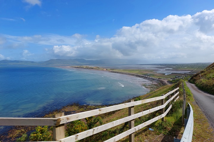
Rossbeigh Beach View
Driving West from Rossbeigh Beach brings you to up a road that clings to the edge of the mountain.
The road is breathtaking as it climbs up the mountain – so make sure your brakes work!! There are not many passing points available.
On a clear day there are fantastic views here of Rossbeigh Strand and across to Dingle.


Rossbeigh Strand
This beach is opposite the fabulous Inch Beach on the Dingle peninsular. Like Inch beach, it is a long sandy beach that sticks out from the land into the ocean.


There is a parking spot here and a play area for kids. The beach is backed by sand dunes. Keep an eye on the tides so you do not get stranded!
Glenbeigh Fairy Forest
This charming little fairy forest can be found if you know where to look.


A great way to entertain your smaller kids and get them to do a healthy walk through the forest. There is a parking space available.
The Glenbeigh Hotel
This is a great little pub, very handily located next to the campsite of Glenross, that does good food and a fine pint of Guinness.
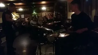
We have had a few brilliant evenings here with live music. A very child-friendly pub.
Here is a video of Liam O’Connor, who holds the Guinness Book of Records for the fastest fingers on an accordion, playing with his family band while we were there:
Glenross Caravan and Camping Park
A great campsite with good facilities. You can hire your own stand caravan or pitch a tent. There is even a place to eat inside.
Nice pitches and good views down to Inch Beach. Located next to the Glenbeigh pub, which is very handy if you want an evening out.


Killorglin Golf Club
This lovely-looking golf course overlooks Dingle Bay and has views of the Macgillycuddy Reeks.
The golf course is close to Kerry airport.

TRAVELING TO IRELAND SOON?
Here are my recommended travel resources for planning your trip:
- Book your flights: Expedia & Kayak
- Hotels & Accommodation: Booking.com, Hotels & VRBO
- Tours & Activities: GetYourGuide
- Car Rentals: Booking.com, Expedia or Discovercars
- Interactive Wild Atlantic Way Guide Maps
- Travel Essentials: Ireland Packing List
Next Route – Deviation off the WAW
Next Route – Going South
I have spent many (fun) hours creating this website to help people travelling the Wild Atlantic Way. If you found it useful and it helped you plan your trip, please consider donating towards my petrol/gas bill! Many thanks!
Last Updated on November 23, 2025 by Gav